A Beginner's Guide to Exploring the Kent Downs National Landscape
The Kent Downs National Landscape is the chalk spine of north Kent: a long, crumpled belt of beech woods, sheep-cropped grassland, orchards, sunken lanes and flint villages that runs from the edge of London toward the White Cliffs. It is beautiful, but it is also a working landscape with real weather, real mud and hundreds of paths. If you have never walked here before, the choice can be the hardest part. Start small, learn the map, and let the hills do the rest.
What makes the Kent Downs worth a day
This is not a single park with one entrance. The Kent Downs stretch across a wide band of countryside, crossed by the North Downs Way National Trail and stitched together by public footpaths, bridleways and quiet lanes. That variety is the appeal. In one day you can walk through ancient parkland at Knole, climb to a chalk ridge above Wye, drop into a village such as Chilham or Lenham for lunch, and finish on the cliffs at Dover.
For a first visit, resist the urge to tick off every highlight. Pick one area, give yourself three to five miles, and allow time to stand still. The Kent Downs reward slow walking: the way a path opens onto an orchard, the sudden view from a field edge, the smell of rain on chalk.
First-timer routes that rarely disappoint
Knole Park, Sevenoaks
A gentle three- to four-mile loop from Sevenoaks town or station into Knole Park. Wide tracks, ancient trees and fallow deer make it a forgiving introduction. It can be muddy after rain, but it is hard to get seriously lost. Good for families, short winter days and anyone testing new boots.
Ightham Mote and Oldbury Hill
A four- to five-mile circuit linking the moated manor at Ightham Mote with woodland and the earthworks of Oldbury Hill. Expect steady climbs, roots and mud. If you drive, check current opening times and parking arrangements before you travel.
Wye Downs and the Devil’s Kneading Trough
A three- to four-mile walk from Wye village onto chalk downland. The valley is steep, the views are wide, and the surface is slippery when wet. Wye has a railway station, which makes this one of the easiest car-free options in the Kent Downs.
The White Cliffs of Dover
A three- to five-mile out-and-back from the Langdon Cliffs area toward South Foreland Lighthouse. The scale is dramatic, and so is the wind. Stay well back from the cliff edge, keep dogs close and avoid the exposed top path in poor visibility.
Map reading without overthinking it
You do not need to be a cartographer. You need one decent map and the habit of checking it before you move, not after you are unsure. An Ordnance Survey Explorer map at 1:25,000 shows field boundaries, woodland, contours and rights of way. The same area is available on mapping apps, but download it offline and carry a paper copy or a charged power bank.
Start with these basics:
- Orientation: turn the map so it matches the ground. If a wood is on your left, it should be on the left of the map.
- Rights of way: paths are marked by coloured dashes. Check the legend, because a footpath, bridleway and byway have different rules.
- Contours: lines close together mean steep ground. They are your best warning before a climb.
- Grid lines: each square is one kilometre. Use four figures for a rough location and six figures when you need a precise point.
- Timing: allow roughly three kilometres per hour on rough chalk paths, then add extra time for hills, stiles and photos.
Before setting off, note your start point, direction of travel, a midpoint and at least one escape route back to a road or station. If the path disappears under crops or mud, stop and check the map rather than pushing through.
Safety, livestock and the Countryside Code
The Kent Downs are not dangerous by default, but they are rural. Weather changes quickly on high ground, phone signal can vanish in valleys, and chalk turns greasy after rain. A little preparation goes a long way.
- Tell someone your route and expected return time.
- Check the forecast and turn back if conditions worsen.
- Wear grippy boots with ankle support; trainers are fine only on short, dry, low-level paths.
- Carry water, a snack, a waterproof jacket and a basic first-aid kit.
- Keep dogs under effective control around livestock. Put them on a lead near sheep and cattle, and always clean up after them.
- Leave gates as you find them, take litter home and do not disturb wildlife.
- On roads without pavements, walk on the right so you can see oncoming traffic. Take extra care at blind bends.
- If cattle approach, stay calm, do not run, and move to the edge of the field or retrace your steps.
“Respect everyone, protect the environment, enjoy the outdoors.” The Countryside Code is short, but it covers almost every awkward moment you will meet on a chalk path.
When to go and what to pack
Each season gives the Kent Downs a different character. Spring brings bluebells in the beech woods and lambs on the chalk, though paths can still be deeply muddy. Summer is best for early starts, long evenings and orchard walks, but exposed downland can feel hot and shadeless. Autumn is arguably the finest time: beech leaves turn copper, light turns golden, and the crowds thin out. Winter offers clear, bracing views, but daylight is short and some paths become almost impassable.
Pack for the season, not for the photograph. In summer, bring sun cream, a hat and more water than you think you need. In winter, add a warm layer, gloves and a headtorch in case you are slower than planned. A small sit mat or folded waterproof is a luxury when the ground is wet.
Getting there, food and facilities
One of the best things about the Kent Downs is that you can reach several excellent walks by train. Sevenoaks, Otford, Wye, Chilham, Lenham and Dover Priory all put you within striking distance of the National Landscape. Buses serve some villages, but they are often infrequent, especially on Sundays, so check times before you rely on them.
Villages such as Chilham, Lenham, Wye and Shoreham have pubs, tearooms or village shops, but opening hours can be limited. Do not assume you will find a café at the midpoint. Carry a packed lunch, fill a water bottle before you leave, and treat a pub stop as a bonus rather than a certainty. If you do stop, check whether the kitchen is serving and whether dogs are welcome inside.
A simple first-day plan
If you want one easy template, try this. Take an early train to Sevenoaks and walk a three-mile loop through Knole Park, keeping the deer at a distance and the map in your hand. Stop for lunch in town, then take a short bus or train to Otford if you still have energy. Alternatively, head to Wye for a car-free day: climb to the Devil’s Kneading Trough, follow the chalk ridge for a mile or two, then return to the village for tea. The point is not distance. The point is to finish wanting more.
Start with one valley, one wood or one village. Learn how the paths feel underfoot, how the map matches the land and how quickly the weather can change. The Kent Downs do not need to be conquered in a weekend. They are better treated as a place to return to, season after season, until the chalk spine starts to feel like home.
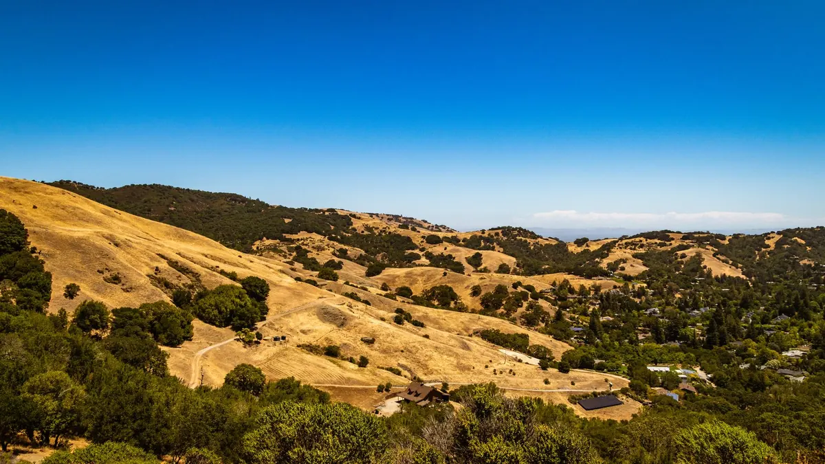
Photo: Robert So / Pexels